

Figure 8: The Relative Sizes of Antarctica and Ecuador

Figure 9: Notice Their Relative Sizes on a Mercator Map
Are all Mercator maps so inaccurate? Why would the world accept such an inaccurate representation of the Earth? Mercator maps represent areas near the equator more accurately. Look, for example, at Ecuador. The standard Mercator map presents Ecuador's size accurately in comparison with Africa. Ecuador is near the vertical center of the Mercator map while both Antarctica and Greenland are near the bottom and the top of the map, respectively.
Figure 8: The Relative Sizes of
Antarctica and Ecuador
Figure 9: Notice Their Relative
Sizes on a Mercator Map
This suggests Mercator maps portray relative distances more poorly, the further one moves from the vertical center of the map.
Can Pete fix this distance representation problem? Must the equator be the vertical center of every map? Of course not! The center of the map is the choice of the cartographer. People in Greenland could hire a cartographer to draw a Mercator map whose vertical center is Greenland. So, too, could any people who happen to live in Antarctica.
[Question: Does this solve the Problem?]
Old maps show the history of map ethnocentricity and inaccurate distance representations. For example, look at a Mercator map made in 1587 (Figure 10).
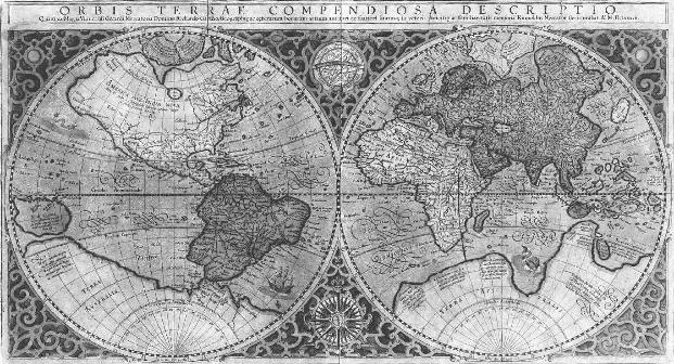
Figure
10: A Mercator Map From 1587
Even in the 1500s, when there were fewer travelers, reasons why leaders of different countries wanted interaction with the rest of the world.
Today people travel great distances from their homes in very short time. An Ecuadorean traveler can be in Daneborg, Greenland, in less than 24 hours. In Daneborg, however, the Ecuadorean map is useless because it represents distance so inaccurately. The traveler is too far from his map's ethnic center. Global transportation and communication allow people intimate contact with the distant corners of the world. Airplane pilots require maps that accurately portray distances on each part of the Earth. Present Mercator maps cannot fulfill this need.
Pete's use of World Wallpaper relies on a map violating constraint concerning the accuracy of distance representation. It violates this constraint so badly that part of the map (near the North and South pole) isn't a map at all. Each has a point from the real world (the North and South Pole) stretched out as a line. Pete added two Mercator map copies, one upside down, to the tessellation. He did this to adjust to the continuity assumption constraint. As he complained in his interview, he wouldn't tolerate a discontinuous trip.


